Explore the Oregon Coast Trail by Section
The Oregon Coast Trail (OCT) traces the entirety of what is arguably the most scenic coastline in the United States. The opportunities for adventure on the OCT are substantial, and there is a little something for everyone. Hikers will enjoy landscapes of rugged off-shore sea stacks crowned with Sitka spruce, delve into thick old-growth forests with dense understories of ferns and salal, hike up and over scenic headlands, and watch marine life and sea birds along Oregon’s marine reserves. Patient observers can search for sea lions and seals, gray and humpback whales, and even vast herds of elk; history buffs can tour lighthouses that are rich with stories and perched on big vistas; and through the entire route travelers will encounter Oregon's charming coastal communities that are each filled with unique character, cozy lodging options, coffee houses, craft breweries, and delicious restaurants serving Oregon Coast food and fare. Add to that the state’s progressive Oregon Beach Bill, enacted with major support from Governor Tom McCall in 1967, which declares the entire coastline from the Columbia River to the border of California to be a public easement for recreational use. This beautiful, unmatched coastline continues to be preserved for the enjoyment of all. The most intimate way to experience what this coast has to offer is on foot, and the OCT allows hikers of all ages and abilities to become more acquainted with this spectacular region.
Totaling approximately 425 miles when walked in entirety (380 miles if the recommended water ferries are used to cross coastal bays/river mouths), it is helpful to divide and think about the OCT in 10 sections, with each section covering roughly 35-45 miles each. The trail is unique because hikers have several options in terms of how to complete it: explore and hike solely those portions of trail that call to you; thru-hike the entire trail in one-go; or section-hike the trail over a longer period of time.

Section 1:
Fort STevens State Park to Oswald West State Park
Starting at the Columbia River in Fort Stevens State Park and ending in the small community of Arch Cape, this segment of trail passes by one shipwreck, one lighthouse, two of the most visited cities on the coast (Seaside and Cannon Beach), and it requires some coordination with the tide. Hikers will also find the only backcountry hut available on the OCT: The Tillamook Head hiker camp boasts three rudimentary Adirondack shelters as well as a dry wood shed for welcome campfires!

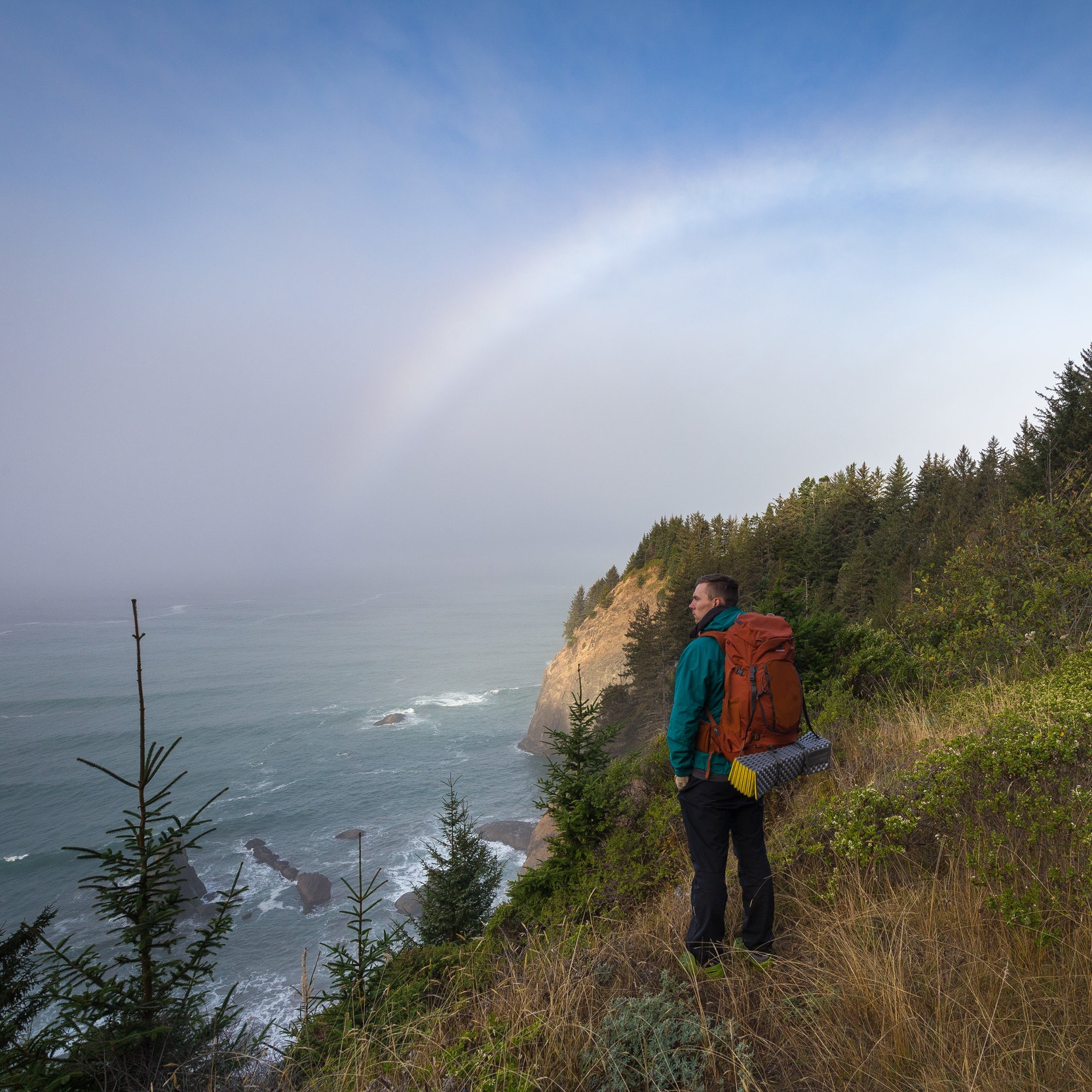
Section 2:
Oswald West State Park to Tillamook River Bridge
This section passes through one of the coast's largest state parks (Oswald West) and leads to its highest point at Neahkahnie Mountain (1,600 feet). Hikers will also encounter the first of the OCT's ferry opportunities in this section; riding across Nehalem and Tillamook Bays prevents the risk affiliated with substantial roadway travel.

Section 3:
Tillamook River Bridge to Bob Straub State Park/Pacific City
Section 3 proceeds along the Three Capes Scenic Route and avoids Highway 101 altogether. Some of Oregon's most scenic coastline can be seen here. The route leads from Cape Meares and its tiny lighthouse over the mighty Cape Lookout, and it ends near the fragile and diverse geology of Cape Kiwanda. Hikers may also choose to ford the potentially difficult crossing of Sand Lake. Many of the smaller coastal communities in this section also display their charm.

Section 4:
Bob Straub state Park/Pacific City to Otter Rock
This section sees some of the longest stretches of roadway travel, which total about 25 miles. Additionally, Section 4 leads through a very populated segment of the coast. After rounding Siletz Bay on Highway 101, the beach through Neskowin gives some reprieve before following the highway over Cascade Head, through the beaches of Lincoln City, and continuing back to the highway for the majority of the journey to Otter Rock. Hikers will encounter frequent viewpoints and overlooks that are ideal viewpoints for spotting whales during their migrations.

Section 5:
Otter rock to Heceta Head
From Newport all the way south to Heceta Head Lighthouse, this longer 54-mile section has about 28 miles of sandy beach walking along with a periodic bridge walk over major bays and inlets. The ancient shield volcano known as Cape Perpetua juts 800 feet above the ocean, affording panoramic views from its historic stone shelter. The segment passes by two lighthouses in Newport and ends at one of the most iconic lighthouses on the coast, Heceta Head.

Section 6:
Heceta Head to North Bend
The tunnel just south of Heceta Head Lighthouse may just be the most dangerous obstacle for hikers of the OCT. With no shoulder and heavy, high-speed traffic, it is highly recommended that hikers find another form of transportation on this highway segment. After dropping down off the rugged coast and through the welcoming town of Florence, the trail crosses a long, continuous beach leg of nearly 15 miles. Then the trail shares the beach with OHVs through the largest expanse of temperate coastal sand dunes in north America, the Oregon Dunes National Recreation Area, which begins just south of Reedsport.

Section 7:
North Bend to Bandon
The route leaves the dunes behind and passes through the small town of North Bend, where an optional side trip to Cape Arago should be highly considered. Once a vast luxury estate, Shore Acres State Park sits on a rugged bluff that sees some of the largest waves in the state if the swells are right. This will add a total of 7.6 miles onto your trip. This section ends in the scenic town of Bandon, where visitors can spend time appreciating the marvelous sea stacks at Face Rock.

Section 8:
Bandon to Humbug Mountain State Park
Section 8 includes the last substantially long beach, which lies at the start of this section. The 16.5-mile walk from Bandon to Floras Lake gives the now intrepid OCT hiker an opportunity to reflect on previous beach crossings and appreciate the unique white cliffs near Blacklock Point that flank the beach. The trail passes the aptly named Cape Blanco and then follows some non-vehicle pavement on the old Highway 101 before reaching Humbug Mountain.

Section 9:
Humbug Mountain to Pistol River
The trail is, again, along the highway for the first part of this section, and pedestrian travel is risky. As is common on most of the roadway segments of the OCT, rugged coastal views abound. Then there is another beach segment followed by Otter Point. The route continues through the town of Gold Beach and is followed by some old-fashioned dirt trail segments through Cape Sebastian before reaching Pistol River.
Section 10:
PIstol River to California Border
The final section begins in one of the most photographed stretches of coastline in the state. Samuel H. Boardman State Scenic Corridor is where the forest literally meets the ocean via broken coastline: Dozens and dozens of tree-crowned sea stacks cascade away from the shore. The trail is back on pavement for the final time through Brookings, Oregon's southernmost town, before it rejoins the beach and crosses into California.
IMPORTANT CONSIDERATIONS FOR HIKING THE OREGON COAST TRAIL:
Currently a significant portion of the route is on pavement. Of the roughly 425 miles, a total of approximately 160 miles follows roadways, and the majority of that mileage is along the shoulder of U.S. Highway 101. There are other options for modes of transportation: Public buses are available through all counties except for Lane County, there are a few ferry options across some of the major bays and rivers, and hikers can also take private taxis (detailed information is provided in each section guide and on the Transportation Options page). There is also the possibility of section-hiking the trail using a vehicle shuttle and avoiding the busy roadway sections altogether.
Most visitors experience the OCT in small day trip segments, and there are plenty of wonderful overnight possibilities for lodging. That said, it is certainly possible to complete the OCT in one go, and there are a few different options for overnight stays. With some advanced planning, there are plenty of hotels, lodges, bed-and-breakfasts, and/or vacation rentals that can be booked each night. Another option is to camp. There are many well-developed and well-maintained state park and national forest campgrounds near or along the trail, and most offer hiker/biker camps (camping for around $8 per night). Or, perhaps, a combination of the two makes sense. Undeveloped camping right on the beach is also permitted on some, but not all, of the route's beaches.
The Pacific Northwest sees as much as 200 inches of rain annually on some areas of the Oregon coast. The driest months, and therefore the best time to hike, are mid-June through September. This is a narrow window in which to hike the trail, but it is the most highly recommended time. The rest of the year can be quite wet, with substantial storms in the fall and winter. The trail, however, is doable year round. Seasonal streams must also be considered because there are a significant number of water crossings. There are also several points that can only be rounded at low tide, which is most efficiently accomplished in the summer to early fall given the ocean's temperature and the risk for exposure in the colder months. The tide does change significantly in height with winter storms and ocean swells. Some bay inlets and rivers may be forded in the warmer and drier months. Detailed information can be found in each section's guide.
The OCT is an ongoing project that is being continuously improved by the Oregon Parks and Recreation Department. In addition to the local trail groups, cities, and counties that have worked to improve the trail, the National Coast Trail Association has been a significant advocate for the completion of the OCT. The association dreams of one long and continuous trail along the coastline between the northern and southern borders of the United States totaling about 10,000 miles. While the route recommended here is the official route determined by the respective land management agencies, other route options and linking up with adjacent trails is possible. At the time of this publication, trail marking was substantial through the northernmost five sections with sparser and sometimes nonexistent marking through the southernmost five sections. OPRD is initiating additional efforts to install needed trail markers. The detailed narratives and photos you find here are the most comprehensive and readily available online resources. Helpful information can also be found in Connie Soper’s book: Exploring the Oregon Coast Trail: 40 Consecutive Day Hikes from the Columbia River to the California Border and on the Coast Trails site.